


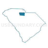
Lando Voting District, Chester County, South Carolina
About
Outline

Summary
| Unique Area Identifier | 665443 |
| Name | Lando Voting District |
| County | Chester County |
| State | South Carolina |
| Area (square miles) | 6.44 |
| Land Area (square miles) | 6.44 |
| Water Area (square miles) | 0.00 |
| % of Land Area | 100.00 |
| % of Water Area | 0.00 |
| Latitude of the Internal Point | 34.76580660 |
| Longtitude of the Internal Point | -81.00656290 |
Maps


Graphs
Select a template below for downloading or customizing gragh for Lando Voting District, Chester County, South Carolina


Neighbors
Neighoring Voting District (by Name) Neighboring Voting District on the Map
- Edgemoor Voting District, Chester County, SC
- Lansford Voting District, Chester County, SC
- Richburg Voting District, Chester County, SC
- Rodman Voting District, Chester County, SC